Phone: (843) 723-3225
Museum: 100 Meeting St.
Archives: 205 Calhoun St.
In May of 1775, what is known today as the “Mouzon Map” was first published in London by Robert Sayer and John Bennett, proprietors of one of the largest print and map publishing businesses in London in the late 18th century. The map’s full title is , An accurate map of North and South Carolina, with their Indian frontier, shewing in a distinct manner all the mountains, rivers, swamps, marshes, bays, creeks, harbours, sandbanks and soundings on the coasts; with the roads and Indian paths; as well as the boundary or provincial lines, the several townships, and other divisions of the land in both the provinces; the whole from actual surveys by Henry Mouzon and others.
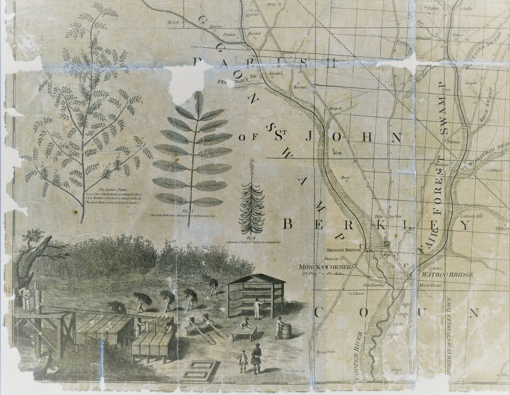
Detail from the 1773 map of St. Stephen’s Parish map depicting enslaved people cultivating indigo. From the collections of the South Carolina Historical Society.
The map was the first of the Revolutionary War era in which North and South Carolina were illustrated together in such detail, and it became the definitive map of the region used during the conflict between Great Britain and her American colonies. It was carried and studied by leaders on both sides of the war. George Washington, French General Rochambeau, and British General Sir Henry Clinton all used it; their copies survive in the collections of the American Geographical Society, the Library of Congress, and the WiIlliam Clements Library at the University of Michigan.
Henry Mouzon, who was of French Huguenot descent, was a surveyor and cartographer from South Carolina. In addition to the 1775 map and other surveying work, Mouzon completed a map of St. Stephen’s Parish in 1773 that featured possible locations for construction of a canal between the Santee and Cooper Rivers. Illustrations of indigo plants and enslaved people working in a field on an indigo plantation are prominently featured in the cartouche at the lower left corner. The SCHS holds the 1775 Mouzon map, the 1794 re-issue, as well as the 1773 map of St. Stephen’s Parish. Drawing on earlier surveys and maps by South Carolinians James Cook and Tacitus Gaillard, as well as John Collet’s 1770 map of North Carolina, Mouzon aimed in his 1775 map to update and accurately illustrate district lines, provide detailed information about the region’s waterways, roads, and other features, and delineate the 1772 western expansion of the boundary between North and South Carolina.
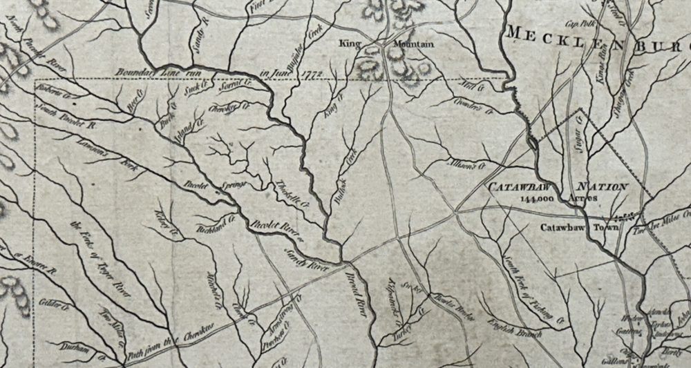
Excerpt of the 1775 map by Henry Mouzon showing the 1772 boundary line between North Carolina and South Carolina. From the collections of the South Carolina Historical Society.
In a 1774 advertisement in the South Carolina Gazette, Mouzon and fellow surveyor Ephraim Mitchell solicited subscriptions for the new map of the colony, explaining that the updates needed to the other extant maps of the time are “not imputed to Want of Abilities, but to the Nature of the subject, which will not admit of Perfection but by gradual Advances.” Mouzon listed some of the updates he intended to make with the new map, including producing the map in a size that would be large enough to provide detail but small enough “for the eye to Command the Whole at one View”.
After its debut in May 1775, the map was later published in Paris in 1777. A 1794 edition was published in London by Laurie and Whittle, successors to Sayer and Bennett. Although there is some debate surrounding how much of the 1775 map was the work of Mouzon and the extent to which other cartographers should be given credit, Mouzon’s name will forever be associated with one of the most monumental and beautiful maps created, and one which played a pivotal role in the southern theater of the American Revolution.